Applications
Signal4Analytics

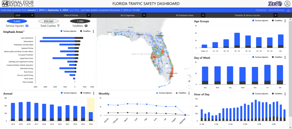
The Signal4 Analytics environment serves as Florida’s statewide crash and citations analytical system that allows federal, state, and local government entities to analyze, create maps and statistical reports of crashes and citations in a consistent, uniform, and timely fashion.
The public-facing Florida Traffic Safety Dashboard provides crash statistics. Public agency employees may request an account to access more detailed crash data through the Event Analysis, Network Screening, Crash Record Search, Standard Reports, and Police Report Search pages.

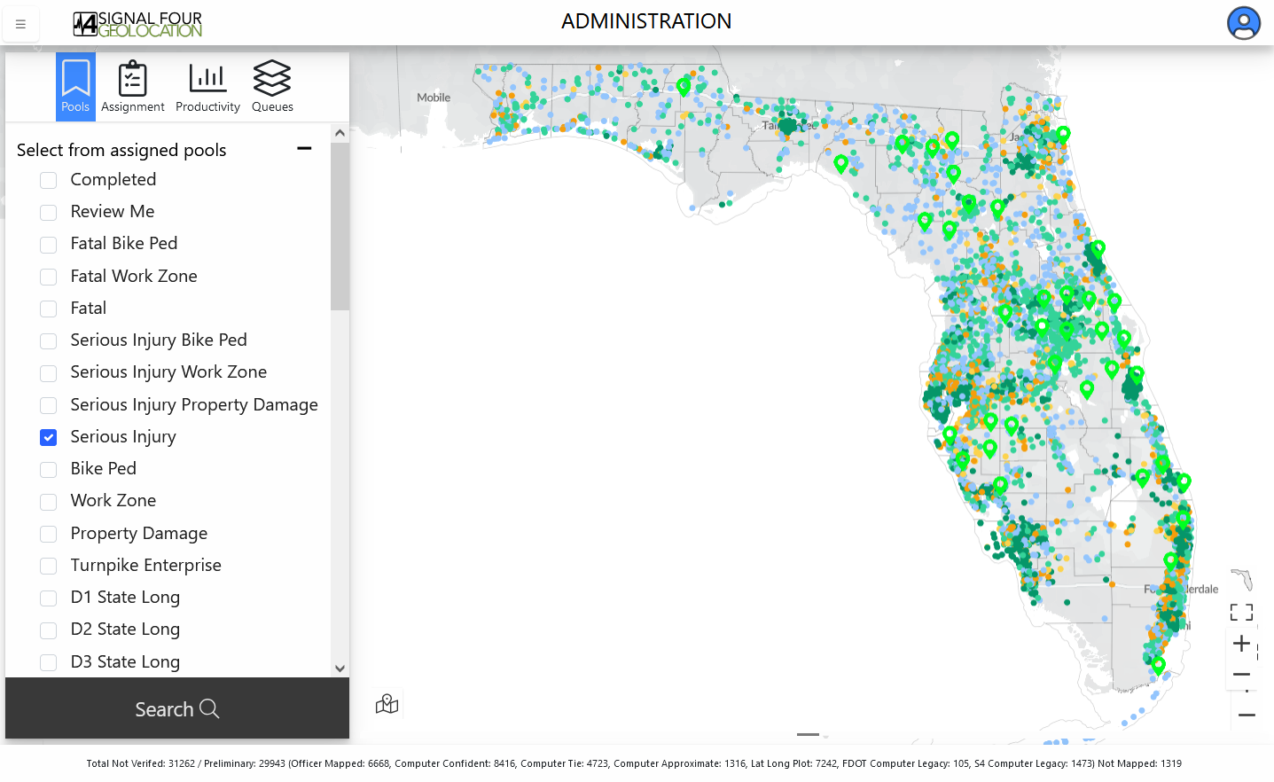
Signal4Geolocation

The Signal4 Geolocation Tool is used for plotting crash points by law enforcement officers.
Rather than create a personal account, the Geolocation Tool must be already integrated into your agency’s e-crash software. Two popular e-crash software packages which have Signal4 Geolocation integrated are TraCS and SmartCoP.
If you would like for your agency to use Signal4 Geolocation, please contact your agency’s IT department and have them reach out to us.
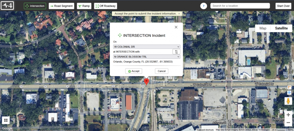
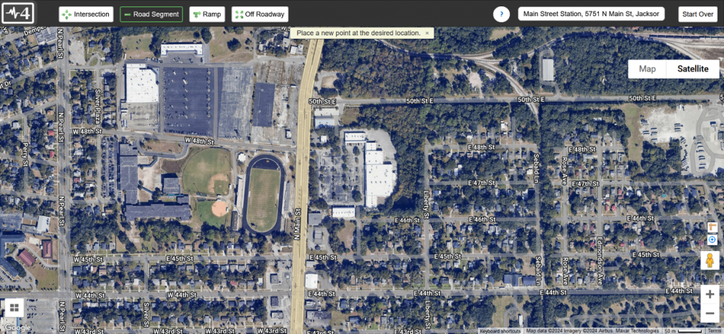
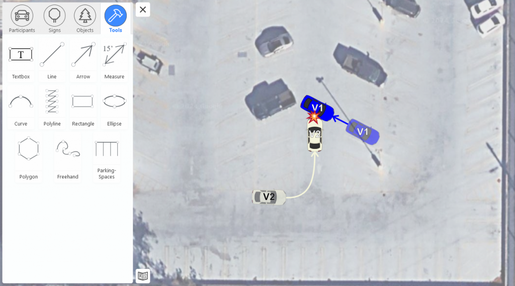
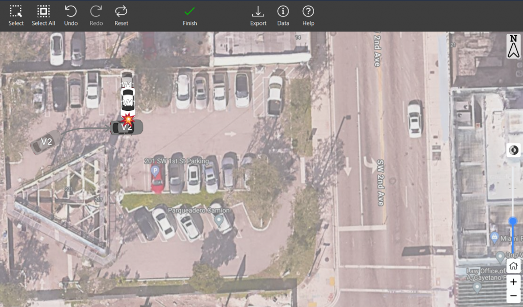
Signal4Diagramming

The Signal4 Diagramming Tool is used for diagramming crashes by law enforcement officers.
Signal4 Diagramming Tool is implemented by your agency’s e-reporting system. Several systems used across the state, such as TraCs, already have the Signal4 Diagramming system implemented and you simply need to reach out and ask your e-reporting system for access.
For those that do not have the system implemented, reach out to your agency’s IT department and direct them towards us.
Signal4DGT
The Signal4 DOT Geolocation Tool, or Signal4 DGT, is a product for FDOT personnel and select local agency users to validate existing crash reports.